-
Asian Woman Crosses: Bengal swimmer Sayoni Das reportedly became the first Asian woman to successfully swim across the Strait of Gibraltar. This is the main news trigger.
-
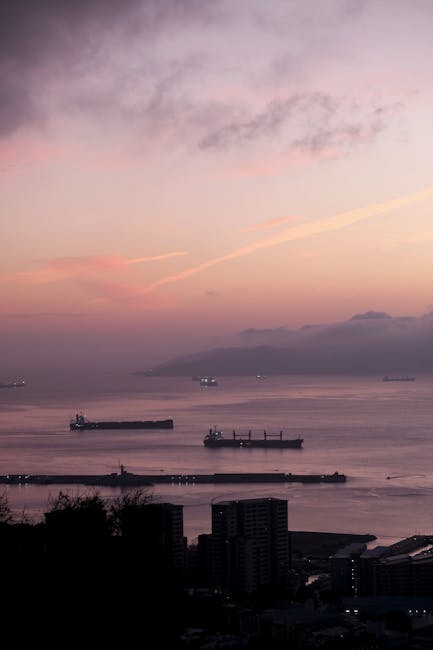
Strategic Waterway: The Strait of Gibraltar connects the Atlantic Ocean and the Mediterranean Sea, separating Europe (Spain & Gibraltar) from Africa (Morocco). This makes it one of the world’s busiest waterways.
-
Geographic Details: It’s approximately 58 km long, with its narrowest point being about 13 km wide between Morocco and Spain. The depth ranges from 300 to 900m.
-
Bordering Countries: Spain and Gibraltar (Europe) lie to the north, while Morocco (Africa) is to the south. The Spanish enclave of Ceuta also borders the strait on the African side.
-
“Pillars of Heracles”: The Rock of Gibraltar and Mount Hacho (or Jebel Moussa) mark the eastern end of the Strait and are historically known as the Pillars of Heracles.
-
Formation: The strait formed due to the African Plate’s northward movement towards the European Plate.
-
Water Flow: A unique water flow pattern exists due to differing salinity levels between the Atlantic and Mediterranean. More saline Mediterranean water flows out underneath less saline Atlantic water flowing in.
-
Key Port: The Moroccan port of Tanger-Med is a significant port located on the Strait.
Gibraltar Strait